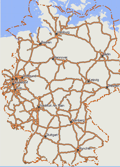
Well finally after many years of empty overview maps, since a few weeks (as written in my last posts) mkgmap was able to write simple overviewmaps. So much faster zooming/panning when zoomed out fast in Mapsource, Basecamp, QLandkarteGT. From todays map update onwards, the overview map now has several layers. This makes the orientation when zoomed out far, still a lot better.
Therefore I also update the Europe map again, because on large area maps, this is even more important. However not only is it faster now on the desktop - but also on the GPS the basemap will become visible earlier, making zooming out work much faster (before I always had to compromise between speed on GPS, vs speed on Desktop, not anymore). Therefore however again I had to add some types to the .typ-file (0x11f04, 0x11f05, 0x10f0a).
Besides the work on the overview map, I will start to work on a worldwide basemap. The problem is that currently some Garmin GPS come with a routeable basemap, in some cases this destructs the routing of detailed maps, like openmtbmaps and velomaps. I will try to create a good basemap, that can go in combination with velomaps/openmtbmap showing the most important map features there are (rivers, lakes, sea, huge cities, borders, motorways, maybe some major railways...).
Fixed bug that Ireland and Northern Ireland was not updated over the last 3 weeks.
Further changes:
add bridge=culvert and bridge=boardwalk.
fix some more bugs related to autorouting in velomap/openmtbmap
and some more little bugfixes...
the new overview map at 150km zoomed out, Detail level High. Very fast...


Leave a Reply
You must be logged in to post a comment.